While South Carolina is not known for its earthquakes, it does experience between 2 and 5 felt earthquakes a year. These earthquakes tend to be between magnitude 2.0 and 5.0 on the Richter scale and cause little damage, approximately 71 earthquakes of this size were recorded in SC between 1973 and 2007, as shown in the image from the USGS/NEIC above. However, the number of smaller, not felt, earthquakes are actually much larger and only recorded at local stations such as those operated by Pradeep Talwani from the University of South Carolina (http://scsn.seis.sc.edu/).
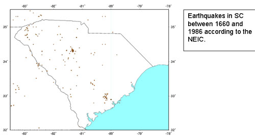
Seismically, South Carolina been active since the first settlers arrived as shown below on the map of earthquakes that occurred in South Carolina between 1660 and 1986, these earthquakes are based on personal accounts and evidence of damage as well as seismographs in the later years.
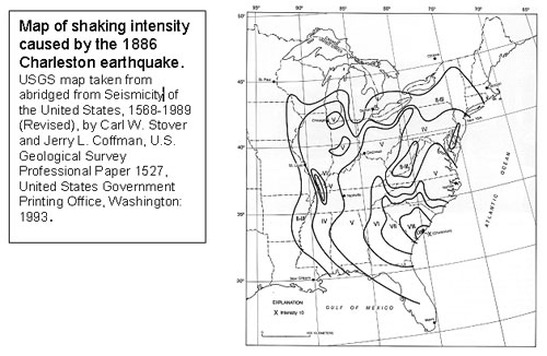
However, Charleston is perhaps best known for the earthquake of 1886 which measured as a magnitude between a 6.9 and a 7.3 on the Richter scale and devastated Charleston and Summerville causing massive damage and more than 60 deaths. That earthquake was so large that it was strongly felt as far north as Chicago. The map below shows the “felt” areas for the Charleston earthquake as notations on the Mercalli magnitude scale.